

The world has seven continents (Asia, Africa, North America, South America, Antarctica, Europe, and Australia/Oceania) and five oceans (Pacific, Atlantic, Indian, Southern, and Arctic). Some classrooms teach six continents or four oceans instead, so it helps to pick one model and stick with it for a lesson.
TL;DR:
- Over 70% of Earth’s surface is covered by water, making map-based teaching models highly flexible due to the planet’s mostly oceanic surface.
- The Southern Ocean was only officially recognized in the early 2000s, so older maps often omit it and use a four-ocean model.
- Continents like Europe and Asia are technically one landmass called Eurasia, and Oceania includes Pacific island nations beyond the continent of Australia.
- Tectonic plates move between 2 to 10 centimeters annually, causing continents to shift over millions of years, which affects map accuracy over time.
- Interactive activities such as puzzles, color-coded worksheets, and songs significantly improve memory retention of continent and ocean names compared to memorization alone.
Table of Contents
- Learning the Seven Continents, One Fact at a Time
- Five Oceans, Five Personalities Worth Knowing
- Size, Confusion, and the Maps That Keep Changing
- Fun Ways to Make the Names Stick
- Why the Map You Teach Is a Choice, Not a Fixed Law
- Ready-to-Use Lessons From Edhed Learning
- Sources
- FAQ
Learning the Seven Continents, One Fact at a Time
Each continent has its own personality once you get past the names. Giving kids one memorable fact per continent makes the list stick far better than plain memorization.
- Asia is the largest continent by area and holds more than half the world’s population, stretching from Turkey to Japan.
- Africa ranks second in size and is where scientists trace the earliest evidence of the human species.
- North America runs from the Arctic ice down to the Panama isthmus, holding everything from glaciers to deserts.
- South America is home to the Andes, the longest mountain range on land, and the Amazon rainforest, which produces roughly a fifth of the planet’s fresh water flow into oceans.
- Antarctica sits buried under ice and has no permanent residents, only rotating scientists at research stations.
- Europe is small in area but dense in history, packing dozens of countries and languages into a relatively tight space.
- Australia is often taught as its own continent, while Oceania is the broader region that also includes Pacific island nations like Fiji and Samoa. Both terms show up in classrooms, and knowing the difference between Australia and Oceania clears up a lot of confused questions.
Five Oceans, Five Personalities Worth Knowing
Oceans do not stay neatly separate. Scientists increasingly describe them as one connected body of water, split into five named sections mostly for convenience and navigation.
- Pacific Ocean is both the largest and the deepest, containing the Mariana Trench, the lowest known point on Earth.
- Atlantic Ocean is the second largest, separating the Americas from Europe and Africa.
- Indian Ocean is framed by Asia, Africa, and Australia, and it warms fast, which shapes monsoon weather across South Asia.
- Southern Ocean wraps around Antarctica and is defined less by coastlines and more by the Antarctic Circumpolar Current.
- Arctic Ocean is the smallest and shallowest, mostly covered in floating sea ice around the North Pole.
Quick fact: the ocean covers roughly 70.8% of Earth’s surface, which is why maps of “the world” are really maps of mostly water with some land floating in it.
Size, Confusion, and the Maps That Keep Changing
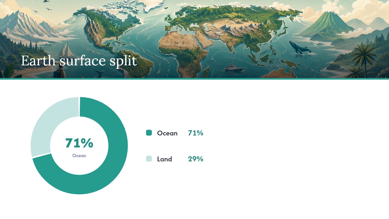
Ranking the continents by size goes Asia, Africa, North America, South America, Antarctica, Europe, then Australia. Oceans rank Pacific, Atlantic, Indian, Southern, then Arctic. About 29% of Earth’s surface is land, and the other 71% is ocean, so any classroom globe is showing you a planet that is mostly blue.
Three mix-ups come up constantly, and each has a clean answer:
- Europe and Asia are physically one connected landmass sometimes called Eurasia, but most curricula still teach them separately for historical and cultural reasons rather than strict geology.
- Oceania is not a stricter version of “Australia.” It is a wider region that folds in island nations, which is why some textbooks use one label and some use the other, per the way Oceania is defined as a region distinct from the continent itself.
- The Southern Ocean was only formally recognized in the early 2000s, so older maps and books often skip it and use a four-ocean model instead.
One more thing worth telling curious kids: continents are not glued in place. Tectonic plates creep 2 to 10 centimeters a year, so the map they are memorizing today looked different millions of years ago and will keep shifting long after.
Fun Ways to Make the Names Stick
Names on a page fade fast. Names attached to an activity, a song, or a puzzle piece tend to stay.
- Pin-the-continent on a blank world map takes 5 to 10 minutes and works for one child or a whole class.
- Jigsaw puzzle maps, where continents are cut-out pieces kids snap into place, run closer to 15 to 30 minutes and double as a fine-motor activity for younger learners.
- Color-by-continent worksheets, where each landmass gets its own color code, help kids build a mental map fast.
- Mnemonics and short songs work well for the ocean order; even a silly made-up rhyme using the first letters of Pacific, Atlantic, Indian, Southern, and Arctic beats flat repetition.
- Quick quizzes using a blank map with numbered labels give a fast formative check without feeling like a test.
Hands-on models like printables and map puzzles tend to help young learners retain geography better than plain memorization alone, which is worth remembering the next time flashcards start to feel stale. Pairing a globe, like a physical 12-inch world globe, with a printable worksheet gives kids something to touch while they learn, which matters more for younger age groups than older ones.
Pro Tip: For remote or mixed-age groups, split the activity: younger kids color and label continents while older kids research one fun fact per ocean, then everyone presents to the group.
Why the Map You Teach Is a Choice, Not a Fixed Law
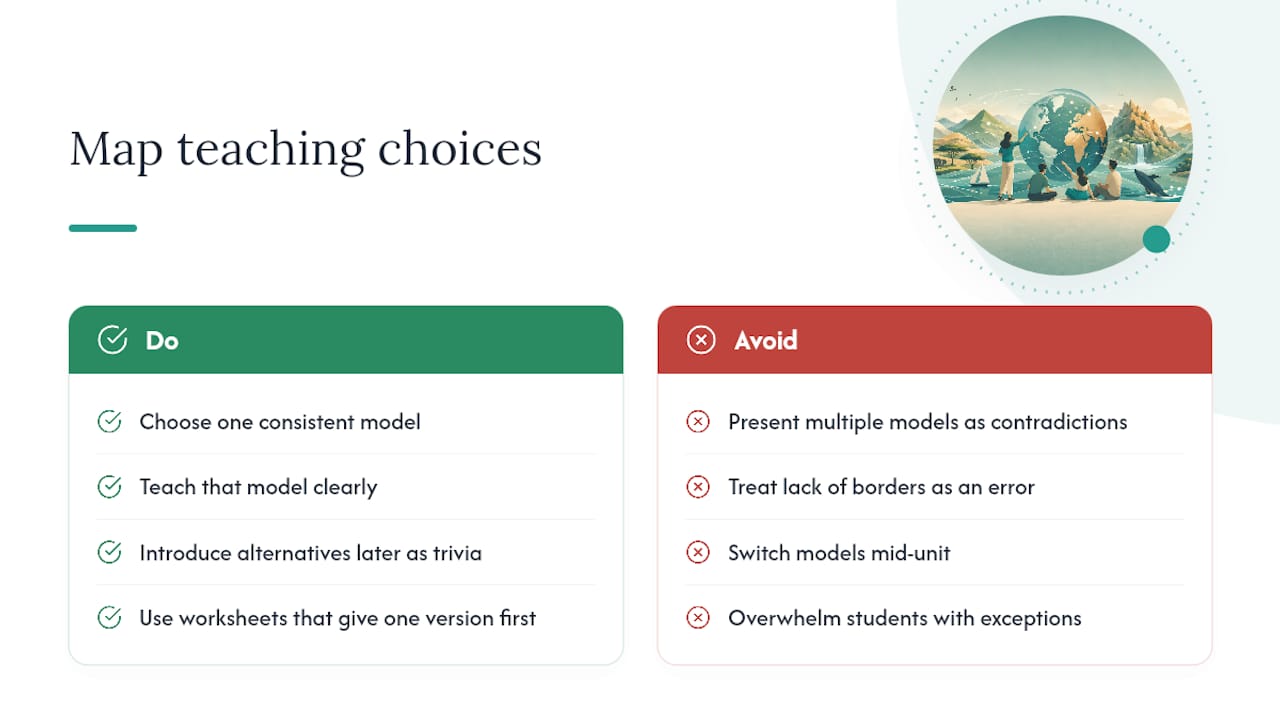
Continents and oceans are teaching models humans invented to organize a planet that does not actually come with borders drawn on it. There is no single scientific rule for defining a continent, which is exactly why some schools teach six continents and others teach seven.
That is not a flaw. It means you get to choose one consistent model for a unit, teach it clearly, and introduce the alternatives later as interesting trivia rather than contradictions. Some educational worksheets are built around that same idea: give kids one clear, confident version first, then let curiosity fill in the exceptions.
— Shaun
Ready-to-Use Lessons From Edhed Learning
Once the names click, the next step is giving kids something to hold and do, not just recite. Printable packs can help close that gap.
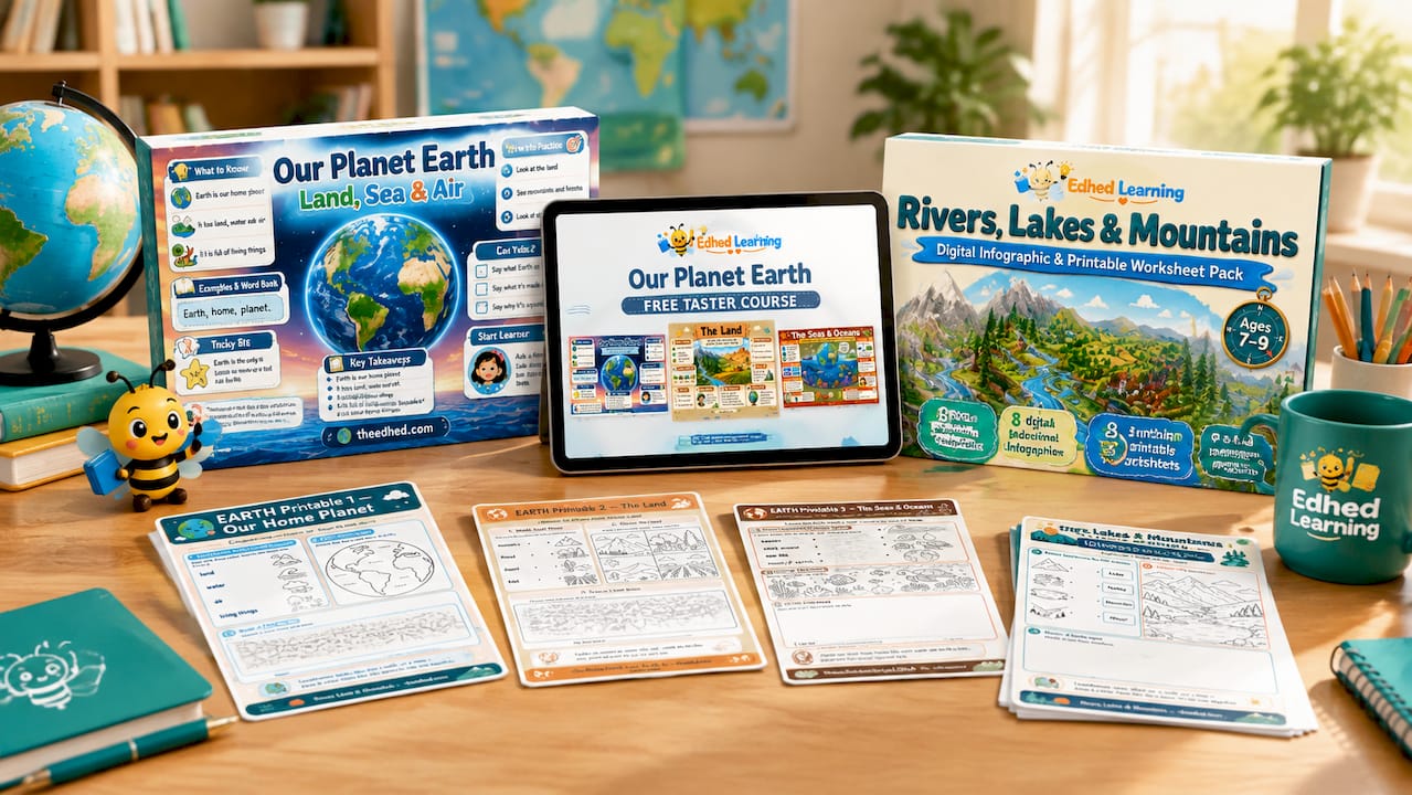
The Our Planet Earth: Land, Sea & Air course bundles infographics, printable worksheets, and suggested lesson flows covering continents, oceans, and the basics of weather and landforms in one download. If you want to try the format before committing, the free taster course gives you three full lessons and worksheets, enough to run one class or a homeschool afternoon and see how the visuals land with your kids. Once continents and oceans feel solid, the Rivers, Lakes & Mountains pack extends the same visual approach into landforms, so kids connect where they live to the bigger map they just learned. All three are instant digital downloads, built to cut prep time down to minutes instead of an evening.
Sources
FAQ
What are the 7 continents and 5 oceans?
The seven continents are Asia, Africa, North America, South America, Antarctica, Europe, and Australia/Oceania. The five oceans are Pacific, Atlantic, Indian, Southern, and Arctic.
What are the two lost continents?
Zealandia and Mauritia are two landmasses geologists describe as mostly submerged “lost” continents, largely hidden beneath the Pacific and Indian Oceans today.
Is the Arctic a continent or an ocean?
The Arctic is an ocean, not a continent: a shallow, mostly ice-covered body of saltwater surrounding the North Pole.
Why is Oceania not one of the 7 continents?
Oceania is a broader geographic region that includes Australia plus many Pacific island nations, while most seven-continent models use “Australia” as the continent name and treat Oceania as the wider region around it.


